![]() BOSNIA-HERCEGOVINA
BOSNIA-HERCEGOVINA
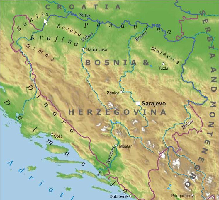
La Bosnie-Herzégovine présente deux ou trois légers massifs au nord comme le Kozara et le Majevica, mais surtout une vaste étendue au sud du massif des Alpes Dinariques.
Bosnia & Hercegovina shows two or three massives at the north like Kozara and Majevica Mountains, but above all a large mountaineous area at the south called Dinaric Alps.
Voici où se situent aujourd'hui les BIGs de Bosnie-Herzégovine.
Here are located the present BIGs in Bosnia & Hercegovina.
Les 6 BIGs se situent fort au sud du pays et deux d'entre eux à l'est de Gorazde sont situés dans la zone où eut lieu le plus de destructions militaires puisque proche de la Serbie. Metaljka est le nom d'un village, le col étant en Serbie et Dobrun semble revêtu jusqu'au monastère mais pas plus haut. On ne peut éviter dans les nouveautés ni le massif du Kozara au nord comprenant le beau monument Mrakovica au sommet d'une route très bien revêtue, ni le théâtre des J.O des jeux olympiques d'hiver d'hiver de Sarajevo à la station de ski de Jahorina. Plus confidentiel mais très touristique le lac Prokosko peut aussi être une excellente alternative.
The 6 BIgs are located at the south of the country and two amongst them at the east of Gorazde where the fights were the strongest (because the neighbouring of the serbian border). Metaljka is the name of a village and the real pass is in Serbia. The road towards Dobrun seems asphalted until the monastery, but not afterwards. Once can't avoid the new climb suggested with the beautiful monument Mrakovica at the top of a very goos surfaced road nor the theater of the winter olympic games in Sarajevo, at the ski resort called Jahorina. More confidential but very touristic, the Lake Prokosko may also be an excellent issue.
PRESENT BIGs - BIGs actuels
On aurait bien une première appréciation comme ce qui suit :
We should have a first impressive idea like the following one :
Analyse personnelle d'Etienne Mayeur - personal analysis
Nom_______paysage____difficulté_____état de la route
Name______landscape___difficulty_____surface of the road
Nevertheless, I didn't like the Rogoj because it's long and there is a dusty tunnel (not climbed the other side). The Dobrun doesn't climb really (7%), only during 1 km and is a succession of flat areas and small climbs with 5-6%. But the manager of the restaurant near the monastery and before the tunnel was very sympathic, he has taken our Euros just like everybody in the shops at Sarajevo and has been agreat help for us. The Cemerno coming from Gacko has a superb super-landscape. Let's note that contrarily of what was written before, the war hasn't lat any visible destructions on the roads (they are superbly surfaced annd asphalted). Only some holes on the front of the houses recall that fact and many houses seem to be under construction but not finished. Croatia has the Sea and the isles on th underground, Bosnia, but Cemerno-Gacko, has the forest.