R10
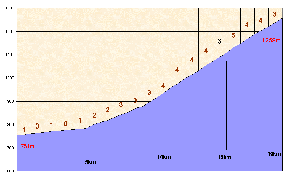
Pasul BUCIN -E1259m
272
Europoints [5th Class] 13,3779 EuroflashLocalisation - Location
|
Pays/country |
ROMANIA |
|
Province |
Transilvania |
|
Latitud pied-foot |
N 46°41,923' |
|
Longitud pied-foot |
E 25°29,073' |
|
Village pied / Foot |
Gheorgheni |
|
Latitud sommet-top |
N 46°40,161' |
|
Longitud sommet-top |
E 25°21,453' |
|
Road - route |
N13b |
Versant est - Eastern side
La traversée de Gheorgheni sur une rue centrale large mais horriblement défoncée n'est pas une sinécure. La suite non plus avec un faux-plat long et fastidieux réduit à trois trop longues interminables lignes droites avec la montagne en toile de fond. Enfin, quelques maisons laissent augurer un changement. Une épingle à droite entame l'ascension et une autre à gauche nous y installe. Le revêtement paraît très agréable quand soudain après deux kilomètres, il se perd en dix mètres et devient un chemin de terre fort cyclable, certes, mais plus goudronné du tout. On choisit souvent le côté gauche pour y trouver l'endroit le plus roulant. Nombreux virages sous les arbres. Le pourcentage n'est jamais très élevé. Une dernière ligne droite mène à l'ouverture du col, seulement matérialisé par une petite borne nominative. La descente de l'autre côté était également entièrement muletière en 2002.
The crossing through Gheorgheni on a large central street but horrifically destroyed is not a dream. The following section too, with its long , too long staraight line with 1:50 with the mountain just far away in front of us. At least, a few houses announce the change. An hairpin to the right starts the climb and another one to the left put you inside. The surface seems very well when suddenly, in ten meters, there is no more surface at all. It's a gravelled road with no problem to ride, but a gravel road. Man often chooses the left sqide of the road to ride better. Many curves help you to climb under the trees. The gradients are always low. A last straight line leads you to the opening, the pass, materialised with a small stone showing its name. The downhill on the other side was a gravel road too…in 2002.
Me(a)sures GPS : km 0 Pied/foot : 754m - Sommet-top : 1259m
|
0.5 |
1 |
1.5 |
2 |
2.5 |
3 |
3.5 |
4 |
4.5 |
5 |
|
756 |
762 |
764 |
767 |
773 |
774 |
776 |
779 |
781 |
785 |
|
5.5 |
6 |
6.5 |
7 |
7.5 |
8 |
8.5 |
9 |
9,5 |
10 |
|
802 |
811 |
819 |
832 |
844 |
855 |
871 |
878 |
898 |
915 |
|
10,5 |
11 |
11,5 |
12 |
12,5 |
13 |
13,5 |
14 |
14,5 |
15 |
|
938 |
958 |
976 |
998 |
1015 |
1031 |
1055 |
1072 |
1090 |
1109 |
|
15,5 |
16 |
16.5 |
17 |
17.5 |
18 |
18.5 |
19 |
||
|
1132 |
1149 |
1169 |
1188 |
1205 |
1221 |
1238 |
1259 |
Graphique - Graphic
Photos / pictures
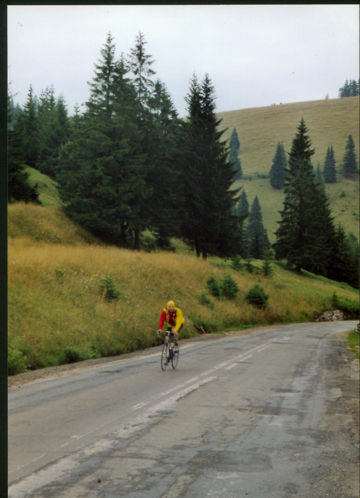
Johan Verlaet se promène dans les pourcentages faibles des contreforts du Pasul Bucin.