 BIG N°209
BIG N°209
Cap Fréhel
climb of 8th class - ascension de 8ième catégorie
Viens, je t'emmène au vent...
| Altitude | 81m |
| Pied/Foot | 21m |
| Diff.level/dénivel. | 60m |
| average % moyen | 1,6% |
| maximum % | 8,0% |
| Length / Longueur | 3,8km |
| EUROPOINTS | 55,5 |
| EUROFLASH | 10,134 |
1. General Description générale
"Fréhel à vent, costaud après !" Tel est le dicton cyclogrimpeur du compagnon d'armes à pédale capable d'assumer Eole à 70km/h de face et tournoyant. Du Port dit du sud-ouest, ou plus précisément de la plage ouest, à travers la lande de Fréhel, le versant sud-ouest du Cap Fréhel est à coup sûr un cap à citer. Si la bleuté du ciel est mouette, le vent nous parle et fait de Fréhel un cap oral.
"Frehel in the wind, and the cyclist wins !" Here is the cycloclimbing slogan of our "brothers in low" BIGs when they assume in your company Eole and his crazy speed of 70km an hour. From the Harbour called "Port du sud-est", or more precisely from the beach of the west, throughout the "lande of Frehel", the west-southern side of the Cape Frehel is for sure worth of touring. If the birds sing in the blue sky, the song of the wind sings in our red ears.
Journal de bord
Dimanche 11h. Voiture stationnée à côté du phare au sommet avec 0°C de température et 70km/h de force de vent. Descente vers la plage-ouest. Pied à la plage ouest, au carrefour venant de Plévenon et qui indique la direction du Cap Fréhel sur un panneau de signalisation. La route pivote à droite pour quitter la plage de manière brusque avec du 6 à 8% sur plus de 300 mètres. Revirant pour longer en corniche parallèllement à la mer, la côte escarpée, la route s'aplanit, parfois redescend un rien avant de refranchir un palier d'un effort brusque. Après 500m, on aperçoit déjà au loin, le but à atteindre, manifesté par le phare et la Tour Vauban, magistral bâtiment sommital. Après 3km, on redescend vers un carrefour et vers la route venant de Plévenon ou des ports à l'est plus lointains. A ce carrefour, à 3300m, prendre à gauche, laisser un parking à sa droite et filer vers le bâtiment. Au sommet, vaste parking et nombreux chemins de randonnée.
Diary
Sunday at 11 o'clock in the morning. Car parked just besides the lighthouse with 0°c as a temperature and 70 km an hour as a power of wind. Downhill with the bike until the western beach. Foot at the western beach, at the crossroad, when comin from lévenon, you'll follow the direction "Cap Fréhel" written on a road-sign. The roads has a right curve with a steep separation from the beach, between 6 and 8% during more than 300 meters. Turning once again to follow now in parallelism the coast and the sea, the road has some flat areas, even downhills sometimes and like a toboggan, some new elevations, short but steep, to win another stage. Already after 500 meters you have your goal in the eyes, marked with the impressive and very large lighthouse on the top of the Cape and the Vauban Tower. After 3 km, there is a new short downhill to the crossroad wih the other roads coming from Plévenon or the more far eastern harbours. At this crossroad, turn to the right, let the car-park on your right and climb to the top where a large car-park is located and where many paths are indicated for the trekkers.
Site légendaire, réserve ornithologique, dominant une mer au bleu teinté d'émeraude, le Cap Fréhel offre un spectacle dont on ne se lasse jamais.
Le cap Fréhel, merveille de la nature, est l'un des sites les plus impressionnants de la Bretagne avec des falaises dominant la mer de 70 mètres.
Le tour du cap constitue une magnifique promenade entre les bruyères et les ajoncs
Il s'étend de la pointe du Grouin à l'Est, jusqu'à l'île de Bréhat à l'Ouest. Par temps clair les îles Anglo-Normandes sont parfois visibles.
A droite du cap, se dresse l'illustre silhouette du fort la Latte.
Le vieux phare, ou Tour Vauban, fut édifie en granit sous Louis XIV, sur les plans de Simon Garangeau. Il fonctionna d'abord au charbon, puis avec des becs à réverbères qui brûlaient à l'huile de poisson.
Le phare actuel, dont le feu porte à 110 km, domine la mer de 103 m a été construit en 1950
Du haut de ses 145 marches on domine la pointe de Paîmpol (à l'ouest) à celle du Groin (à l'est). La nuit, il est même possible d'apercevoir l'éclat du phare de la Corbière, à la pointe sud-ouest de Jersey, à 50 km au large.
2. Graphique- Grafiek - Profil- Perfil
On perçoit toute la variabilité de la côte dont le passage le plus pentu est au début et où le reste se fait en ondulation face au vent..
Man can see the whole variability of the climb whose steepest area is just after the start and where the folloing area is a toboggan against the wind.

3. Maps - Cartes - Kaarten - Karte - Cartografia

Zoom
On a choisi la seule vraie côte partant du carrefour de la route de Plévenon et du port du sud-ouest (il est mis "est" par erreur sur la carte). Au carrefour près du sommet, virage à gauche vers le parking et la tour Vauban
Man ha choosen the lonely real climb starting from the crossroad at the Western Harbour with the road coming from Plévenon. (it's a mistake on the map , "East" is written). At the crossroad, near the top, turn to the left, to the final car-park and the Vauban Tower.

L'ascension est en orange, le long de la mer, partant du carrefour avec la " Rue des Plages", et se terminant par le cul-de-sac en trait blanc.
The climb is in orange color along the sea, starting at the crossroad with the "Rue des Plages", and finishing with a small end-road in white color.

4. Photos internet Pictures
 |
 |
5. Photos perso/personal Pictures

Au carrefour de la route venant de Plévenon, c'est le pied de l'ascension. Suivre "Cap Fréhel".
At the crossroad of the road coming from Plévenon, it's the foot of the climb. Follow "Cap Fréhel".

Juste après le pied se présente la plus belle pente. Entre 7 et 9% nous font quitter le niveau de la mer.
Just after the foot, it's the steepest slope of the climb, between 5 and 7% to leave the level of the sea.
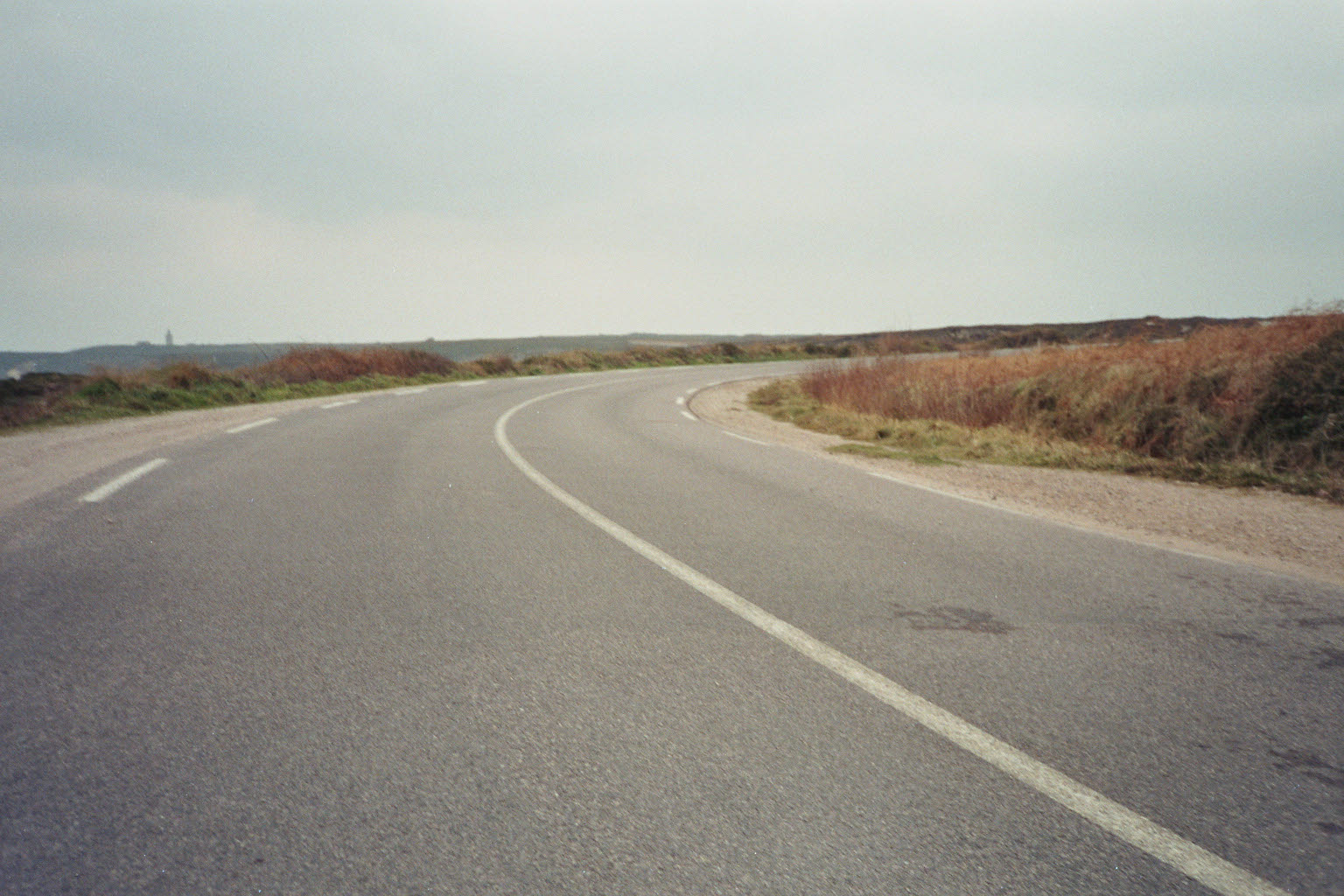
Plus haut, typique de cette ascension, la route large n'est protégée du vent par aucune végétation.
Upper, typical about this climb, the large road isn't protected against the wind from any vegetation.

Et voici le final, on laisse le parking à droite et on file sur la tour Vauban là-bas au fond.
And there is the final section. Leave the car-park on the right hand and climb to the auban Tower there, in the background.